KCG Sanskrit College Bhubaneswar Area Map

The Following Bhubaneswar Area Map Shows KCG Sanskrit College - Lingaraj Temple Road - Gouri Nagar. Please click the Map to see the Complete Area. This Map includes the listed places near KCG Sanskrit College, Lingaraj Temple Road and Gouri Nagar. Places seen in the map are Lingaraj Temple Road, Gouri Nagar,  Rajarani colony, OLd Town, Lingraj Temple Road, Sriram Nagar, Mahatab Road, Samantarapur.

KCG Sanskrit College Bhubaneswar Area Map

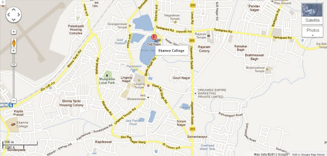
Ekamra College Bhubaneswar Area Map

The Following Bhubaneswar Area Map Shows Ekamra College - Jagannath Sadak - Tankpani Road. Please click the Map to see the Complete Area. This Map includes the listed places near Ekamra College - Jagannath Sadak and Tankpani Road. Places seen in the map are Rajarani Colony, Bindu Sagar Road, Lingaraj Temple Road, Lingaraj Nagar, Mulapadia Park, Ratnakar Bagh, Braheswar Bagh, Old Town, Gouri Nagar, Bhima tanki Road, Gosagareswar Temple, Pandav Nagar.

Ekamra College Bhubaneswar Area Map

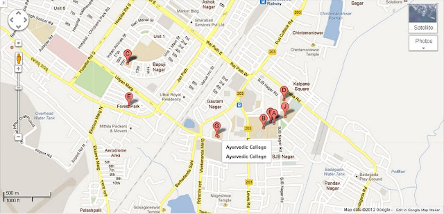
Ayurvedic College Bhubaneswar Area Map

The Following Bhubaneswar Area Map Shows Ayurvedic College - BJB Nagar - Vivekananda Marg Road. Please click the Map to see the Complete Area. This Map includes the listed places near Ayurvedic College, BJB Nagar and Vivekananda Marg Road .Places seen in the map are Barhadanda Sahi Road, Gautam Nagar, Raj Path west, BJB nagar Road, Kalpan square, Nageshwar Temple, Lewis Road, Utkal Royal Residency, Bapuji Nagar, Udayn Marg, Puri - cuttack Road.

Ayurvedic College Bhubaneswar Area Map

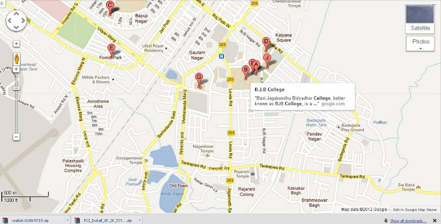
BJB College Bhubaneswar Area Map

The Following Bhubaneswar Area Map Shows BJB College - Gautam Nagar - Kalpana Square . Please click the Map to see the Complete Area.This Map includes the listed places near BJB College, Gautam Nagar and Kalpana Square .Places seen in the map are Bapuji Nagar, Gautam Nagar, Bjb Nagar Road, Raj Path West, Jan path, Utkal Royal Residency,Pandav Nagar, Tank pani  Road, Lewis Road, Rajarani Temple, Rajarani Colony, Ratnakar Bagh.

BJB College Bhubaneswar Area Map

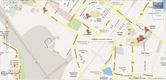
Capital Computer College Bhubaneswar Area Map

The Following Bhubaneswar Area Map Shows Capital Computer College - Ekarma Marg Road - Jan path Road. Please click the Map to see the Complete Area.This Map includes the listed places near Capital Computer College, Ekarma Marg Road and Jan path Road.Places seen in the map are Udayan Marg, Bapuji Nagar, Gautam Nagar, Forest Park, Hospital Road South, Raj Path East, BJB Nagar, Kalpana Square, Aerodrome Area.

Capital Computer College Bhubaneswar Area Map

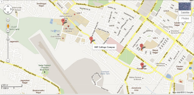
NIIT College Campus Bhubaneswar Area Map

The Following Bhubaneswar Area Map Shows NIIT College Campus - Gopabandhu -governer House Road - Hospital Road South. Please click the Map to see the Complete Area.This Map includes the listed places near  NIIT College Campus, Gopabandhu - governer House Road and Hospital Road South.Places seen in the map are Azad Marg, Quat Main Capus, Udyan Marg, Forest Park, Ekarma Marg, Unit 7, Unit 6, High School Road, Raj Path, Bapuji Nagar, Aerodrome Area, Hospital -chidrens park Road.

NIIT College Campus Bhubaneswar Area Map

Kamala Nehru Womens College Bhubaneswar Area Map

The Following Bhubaneswar Area Map Shows Kamala Nehru Womens College - Udayan marg Road - Raj path East Road.Please click the Map to see the Complete Area.This Map includes the listed places near Kamala Nehru Womens College, Udayan marg Road and Raj path East Road.Places seen in the map are Hospital Road South, Gautam Nagar, Bjb Nagar Road, Kalpana Square, Ashok Nagar, Bhubaneswar Railway Station,  Buddha Nagar, Master Canteen Area, Sachibalaya Marg Road, Raj  path West,  Unit 1, Unit 2.

Kamala Nehru Womens College Bhubaneswar Area Map

ICFAI National School Bhubaneswar Area Map

The Following Bhubaneswar Area Map Shows ICFAI National School - Puri Cuttack -Jharapada Road.Please click the Map to see the Complete Area.This Map includes the listed places near ICFAI National School, Puri Cuttack and Jharapada Road.Places seen in the map are Puri Cuttack Road, Jail Road, Bomikhal, Satya Nagar, Punjabi Colony, Jayadurga  Nagar, Madhusudhan Marg, Sahid Nagar, Rasulgarh Industrial Estate.

ICFAI National School Bhubaneswar Area Map

Indian Academy Of Aeronautical Technology Bhubaneswar Area Map

The Following Bhubaneswar Area Map Shows Indian Academy Of Aeronautical Technology - Jan path South Road -Maharishi College Road.Please click the Map to see the Complete Area.This Map includes the listed places near Aeronautical Technology,Jan path South Road and Maharishi College Road. Places seen in the map are Sahid Nagar, Station Road, Bhoi Nagar, Rama Devi College Road, Ipicol Road, Unit -9,Maharishi College Road, Bomikhal, Puri cuttack Road,  Satya Nagar, Punjib Colony, Bomikhal.

Indian Academy Of Aeronautical Technology Bhubaneswar Area Map

Rama Devi Womens College Bhubaneswar Area Map

The Following Bhubaneswar Area Map Shows Rama Devi Womens College - Maharishi College Road - Puri-Cuttack Road. Please click the Map to see the Complete Area.This Map includes the listed places near Rama Devi Womens College, Maharishi College Road and Puri-Cuttack Road.Places seen in the map are Bhoi Nagar, Rama Devi Colleage Road, Ipicol Road, Station Road, Vani Vihar PH, Jan path South Road, Rasulgarh Indusstrial Estate, Bomikhal, Utakal University, Sachivalaya Marga

Rama Devi Womens College Bhubaneswar Area Map
.

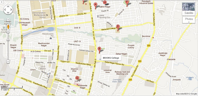
IBOOKS College Bhubaneswar Area Map

The Following Bhubaneswar Area Map Shows IBOOKS College - Maharishi College Road - Satya Nagar Flyover Road .Please click the Map to see the Complete Area.This Map includes the listed places near IBOOKS College, Maharishi College Road and Satya Nagar Flyover Road.Places seen in the map are Sahid Nagar, Maharishi College Road,  Bomikhal, Punjabi Colony, Satya Nagar,Unit -9, Central School Road, Ekamra Vihar,  Unit 3, Kharavela Nagar, Shriya Talkies st, Industrial Area, Railway yard and Washing  Line, Jayadurga Nagar.

IBOOKS College Bhubaneswar Area Map

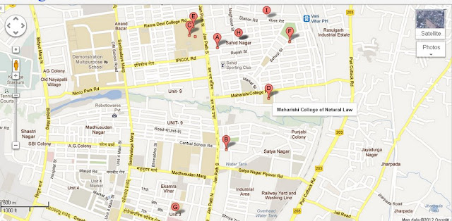
Maharishi College of Natural Law Bhubaneswar Area Map

The Following Bhubaneswar Area Map Shows Maharishi College of Natural Law - Jan path South - Puri-Cuttack Road .Please click the Map to see the Complete Area.This Map includes the listed places near Maharishi College of Natural Law, Jan path South Road and Puri-Cuttack Road.Places seen in the map are
Sahid Nagar, Sahid Sporting Club, Punjabi Colony, Satya Nagar,Janpath South, Satya Nagar Flyover Road, Unit -9, Vani Vihar PH, Jayadurga Nagar, Anand Bazar, Rashulgarh Industrial Estate, Central School Road.

Maharishi College of Natural Law Bhubaneswar Area Map

Utkal University Campus Bhubaneswar Area Map

The Following Bhubaneswar Area Map Shows Utkal University Campus-VSS Nagar Road - Scachivalaya Marg Road .Please click the Map to see the Complete Area.This Map includes the listed places near Utkal University Campus,VSS Nagar Road and Scachivalaya Marg Road.Places seen in the map are

University Girls Hostel, Univ Hospital,Dept of Law, Dept of Geology, Dept of Zoology, Dept of Botany, University Boys Hostel,Dept of Anthropology,Dept of Chemistry ,Dept of Poltical Science.

Utkal University Campus Bhubaneswar Area Map